Glacier Garden, Luzern

Approximately 20 million years ago at the beginning of the Tertiary period, central Switzerland was a tropical paradise, similar to modern day Hawaii. This region was covered under a huge glacier about 20,000 years ago. During this time, glacial water melted and started cutting channels in the ice. When the glacial melt water reached the rock, the enormous pressure (approximately 20 atmospheres) caused the water to make small potholes, similar to what you will see in rivers. With a combination of water currents, pressure, vortexes and rock particles in the water, a pothole measuring 9 feet wide and 6 feet deep can be formed within three years. These processes created the Glacier Garden.

The Glacier Garden has a web site that goes into more detail. Click here to look at it. They have a wonderful museum on the site that explains the ancient geological history of the region, and a mirror maze that's guaranteed to disorient you.

Inside the museum, they had this fossilized baby mammoth, which was discovered in Russia in 1979.


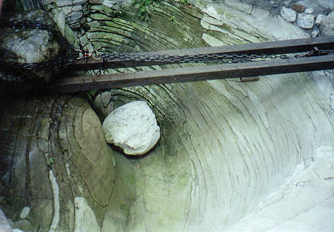
The site was discovered in 1872 by Joseph Wilhelm Amrein-Troller. He purchased land around a rock quarry just outside of the urban area of Luzern, next to the Lion Monument. He intended to excavate a wine cellar in the sandstone to help expand his spare-time occupation as a wine trader. During the first excavations, a small pothole was found on November 2, 1872. Two geologists, Franz Joseph Kaufmann and Albert Heim, recognized the potholes as evidence of the ice age and convinced Amrein-Troller to stop blasting operations and preserve the site. The Glacier Garden was inaugurated on May 1, 1873.

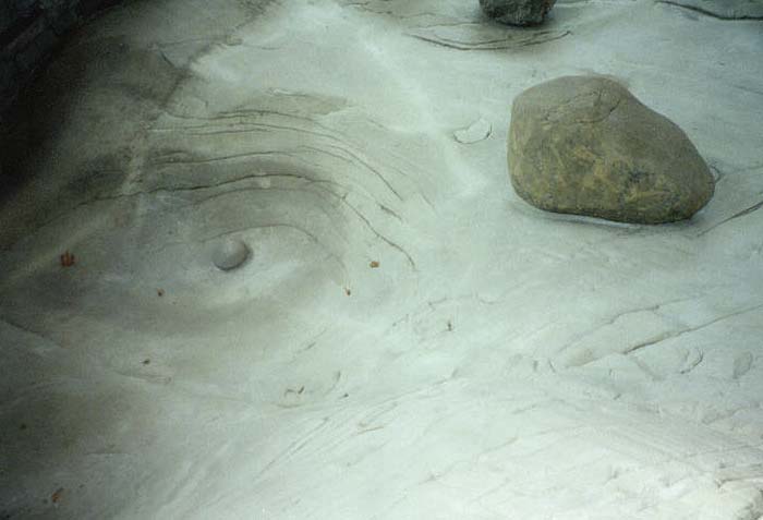
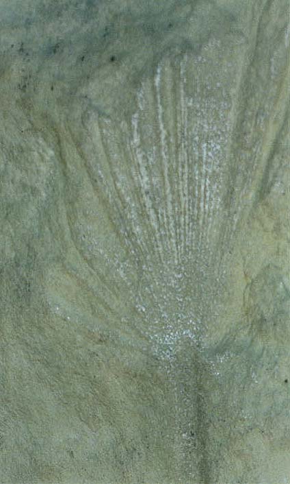
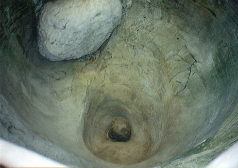
In this picture, you can see how the glacier movement turned the sandstone into a smooth surface. There's also a very small depression on the left, which was the start of a pothole.


These three pictures show how the geological forces thrust the rocks to their present position. If you look at the surface closely, you can see how the glaciers polished the rock surface, indicating the direction of the ice flow. The angle of inclination of the rock strata in the Luzern area is 50 degrees to the north.


This is an imprint of a palm leaf from the sandstone, which indicates that the climate in the area was subtropical 20 million years ago.


Ripple marks were embedded in this slab of sandstone, indicating that it was part of a beach. They are similar to what you will see in a shallow water tide zone along a lake or river.


Many shells and other aquatic animals were also fossiled in the rock.


This is a smaller pothole near the entrance, about 4 feet deep and 6 feet wide. Notice that the rock layers on the left side are vertical, while the other side are horizontal. That was caused by the continuous shifting of the rock.


Here's a larger pothole, which is 13 feet deep and 16 feet wide.


A closeup of the side of the pothole, showing the rock layers.


This is the largest and most beautiful pothole, which is 25 feet wide and 32 feet deep. It was excavated in the winter of 1875/76, and caused a lot of trouble. The elegant pattern of the runways on the walls show the power of the glacial melt water at the bottom of a glacier. The sandstone in the middle of the picture is pointing upward. Also, the hose you see on the right side is needed to drain the water out of the pothole every day, as the ground water seeps through the rocks.